|
picking up in scenic Montana and on to Oregon via Idaho
As we neared the top, nearly 7,000 feet up, the valley below spread out in a wide complicated series of U-shaped glacial excavations, so wide as to be almost impossible to take in at one view. There were “hanging valleys” where intersecting glaciers had cut off the path of the smaller ones, leaving a huge saddle leading to a dropoff of hundreds or thousands of feet. At the summit, we stopped for a break at the rest area and could see the bare rock peaks still towering above us. Along their sides was the effluvia of erosion, the flaking off of ever-smaller pieces flowing down like melting candle wax. Come back here in 10 million years and this summit will be down in the filled-in valley.... if another continental collision hasn’t started the process all over again.
On the other side of the summit pass, the road was more gentle in its slope and the drop-off not quite so intimidating. We could feel the temperature rise as we descended until by the time we stopped for lunch at Kiowa we had to come out of our layers and switch to the ventilated gear. At the table, we spread out the map and contemplated our next move. The plan had been to go on down to Beartooth Pass and Yellowstone; but using the newfound electronic mapping skills I’d learned from Dave, we determined that such a route would have us over 1,000 miles from DuPont on or about Thursday, necessitating a burn across the high desert to get home, possibly involving the dreaded interstate travel. We decided to change course and head back into Idaho and over into Oregon to explore some mountain roads.
We went on south along Route 83, eventually heading toward Seeley Lake. By this time I’d developed a killer head and chest cold, no doubt the gift of some thoughtful passenger on my flight out. (Sharing the beer sampler in Whitefish included more than we thought. In another day, both of us had a serious cold, one which put a new cast on the trip. It’s difficult to concentrate on riding when the wind through the faceshield is spreading nose drippings across one’s face.)
We stopped at a drugstore for various remedies and were soundly warned about watching for deer on the road to Seeley. We did see Bambi and his cousins several times on the route, but thanks to our heightened vigilance, neither deer nor BMW were harmed.
We found the last rooms at the small motel in Seeley Lake, operated by a young man who was from Harlan and at least claimed to know my daughter-in-law’s family.
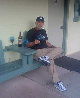
Dinner was at the Dairy Queen wannabe a few yards down the road, brought back to the picnic table outside our room and washed down with a local Montana wine sourced from the combination Conoco gas station, Ace Hardware and wine store a short distance away. What red wine goes best with a burger and fries?
|
|
From Seeley Lake, we headed southwest on Rt. 200, yet another mountain road, down to Missoula for breakfast. Leaving there we started up into the Lolo Pass area, which had been recommended as a road not to be missed, surely something to produce lasting memories. It did, but not entirely of the kind we wanted.
We both got “performance awards “ from the Idaho State Police. We were on route 12 out of Missoula, up over the phenomenal Lolo Pass, enjoying the curves at the Montana speed limit of 70mph. It’s a lovely mountain road, with wide sweepers following the iconic rocky stream, with the occasional set of switchbacks for flavor. Jay said, “That’s the road I’ve been looking for.” We stopped on the Idaho side of the border for a drink of water and a bathroom and ran into a group of riders on modern sport-tourers we’d passed earlier. They seemed impressed that our old Beemers piloted by two old men had overtaken their convoy. They warned us that the speed limit changed on the Idaho side of the line to 50 mph....but apparently we (or I) didn’t take that enough to heart. Shortly after leaving the café we came up behind a black SUV, sort of the standard vehicle in this part of the country and as I swung out to pass it, I noticed the state police logo on the side. He said it didn’t matter, he’d clocked us both coming up behind him at 65 and was reaching for the light switch before I came up beside him. From that point forward we were forced to obey the limit carefully, which changed a formerly very enjoyable bike road into drudgery....beautiful drudgery, but a chore nonetheless. These were curves that would accommodate a fully loaded schoolbus at 65mph, much less a bike, and we were forced to hold it down to 50.
Just down from the site of our lawbreaking, we pulled into a layby and were quickly joined by a very animated young man on a bicycle. He was, by his own account, an “Iron Butt” motorcyclist and gave us
|
|
great detail on how he’d prepped his bike, a Concours, for the long hours in the saddle (extra gas tank, various electronics, etc) and himself (a “Stadium Pal” relief device which would, I think, discourage tailgating.) He said that 1000 mile days on a motorcycle weren't challenging (or masochistic) enough, so he’d decided to ride a bicycle 5,000 miles cross country, corner to corner. He told us about a road called “Whitebird Hill Road” out of the nearby town of Grangeville which had been the old way across the mountain before the new road bypassed it. We took his advice and found one of the best riding experiences of the trip. Whitebird Hill Road was empty of vehicles (including those with official logos) and didn’t have a straight stretch more than 50 yards long for about 20 miles. Jay was on the Mystic and I was doing my best to keep him in sight. The best part was that with the twistiness of the road, neither of us was breaking the speed limit of 55 mph while testing the limits of the tires and our nerves (not always the same limit!). The road eventually connected to Rt. 95 right at the top of the Hells’s Canyon entrance where 95 began it’s descent in a long series of sweepers along the rim of an enormous valley.
|
|
For lodging that evening we found a small motel/B&B in New Meadows, Idaho, operated by a charming woman named JoBeth Mehen and her husband Steve , a plant scientist who had, she said, done some consulting work at UK. The motel part was in two blocks of rooms arranged around a courtyard behind the large 4-square, turn-of-the-century (the one before last) house. Inside the house was the office and a bar in what had been the front parlor. Her husband had constructed it from a single piece of wood, about eight feet long, three feet wide and at least 4 inches thick. He had embedded in the bar geographic markers from the highest summits around. There were tap handles for draft beer and a cooler case behind the bar with some interesting local brews. Jay and I thought that a full bar in the front parlor seemed like an excellent decorating idea, but on further reflection realized that, in our households, this may be a minority opinion.
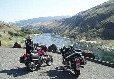
The next morning, we went into the Hell’s Canyon park and crossed over into Oregon at the Browning Dam. From there we found the road up to the overlook where we could see across the 10 mile wide canyon, which is one and a half miles deep. The sign at the overlook says this is the “largest gorge in North America” which is either a case of semantics or an argument for them to sort out with the Grand Canyon folks. One way or the other, it’s big.
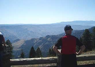
Jay contemplates whether this Canyon is Hell's or Grand
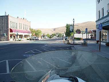
We were advised by some riders we met up there to take the unmarked road from the Canyon access over to 82 and in to Joseph, Oregon. This turned out to be a marvelous road, skirting around the edges of Pete’s Point (elevation 9,700 feet) and down into a picturesque town spread out in the valley, again like in a classic western movie. No gunfights on the main street, though, just tourist stores and excellent restaurants for weary travelers. We ate lunch on the deck of a local brewpub (no beer for us!) and coffee house (you can see their caffeine options at Motleybrew.biz).
Saddling up (though not quite as dramatic as in the westerns) we continued west on 82 down to LaGrand and then to North Powder (don’t these just sound like Shane and Rooster Cogburn must live there?) where we took off on a “white road” (unmarked and un-named roads on the Oregon map) across the Wallowa and Whitman National Forests. We went through the Anthony Lakes Ski area, abandoned at this time of year, and that was the only sign of “civilization” we saw for nearly 100 miles. Riding across the top of the pass, just over 7,000 feet, we could see in the far distance a huge column of smoke rising from the horizon. It resembled those iconic photos you’ve seen of the mushroom cloud from a nuclear explosion. We later learned it was a massive forest fire in the Columbia River Basin, a couple hundred miles from us, but we briefly contemplated our course if while we were up here, “they’d dropped the Big One” ending it all. Our conclusion was, if so, then the heck with the speed limit! But, figuring that wasn’t the most likely explanation for what we saw, we proceeded on our law-abiding way.
Our berth for the night turned out to be the Antlers Inn in Ukiah, Oregon, a town of about 300 souls. The only other choice was an RV park with “cabins” consisting of four wooden walls and bunk beds, facilities outside. The Antlers was a wooden two story structure, festooned on the outside (and inside) with horns of various creatures screwed to the walls.
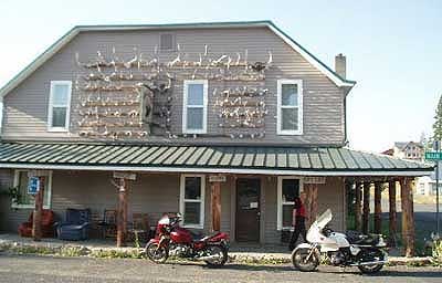
It appears to have been constructed in the 19th century, I think, as a rooming house for miners and loggers with a minimum of fuss and attention to comforts. The rooms were all on the second floor, small, hardly large enough for two beds, requiring that some of our gear be stowed on the bed as there wasn’t room on the floor to walk around it.
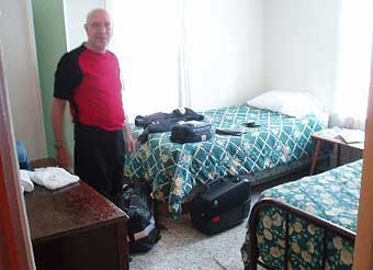
Compared to Jay's lodgings in Iraq, this looked pretty good
The bathroom facilities were at the end of the hall, shared with the other guests, who were on this occasion government bat census workers who didn’t come in from their labors until about 3am. The “lobby” was small, maybe 8 x 10 with a secured window for check in and again, more antlers. Our check in clerk was also the waitress at the bar nearby, the only eating establishment in town. We walked down there and took our seats at one of the bar tables and were given our choice of entrees....burger or burger & fries. The beer selection leaned heavily toward made in St. Louis, but there were a few local brews, enough to get us through dinner satisfactorily. We listened with rapt attention while the waitress described in detail to some of the regulars how much better things were now that she’d gotten her new teeth.
From Ukiah we took another white road over to Heppner, going across Black Mountain (a mere 5,900 feet up) following Willow Creek to its reservoir. The mountains here are smoothly rounded, farther along in the erosion process, and shaded in various hues from the brown side of the crayon box. This is what “burnt Sienna” was made to color. Vegetation is low, scrub trees and bushes, just enough to provide shelter and food for some very hardy critters who live here. Along the banks of Willow Creek there are trees, looking almost like a planted lane for a park, but really just reflecting that this is the only place where there’s enough water for anything more than a few feet high. The town of Heppner is arranged along the valley floor, like all the others, and is supported by the vacationers who come for boating at the reservoir. Apparently that recreational paradigm doesn’t include breakfast, for there was no establishment serving such and the young attendant at the gas station gave me a quizzical look when I inquired, as if she’d never given that any prior consideration.
Up the valley road another 20 miles was the town of Ione (yes, another one) with one restaurant. There the waitress informed us that she liked cooking pancakes, but sometimes got “carried away” on the size. We accepted the challenge and were rewarded with hotcakes that overflowed the large plates meant to contain them. It took a while, but we managed to get most of them eaten while we perused the map to figure out where we were going from here. Folks at the café gave us directions to another white road (“just past the school”....as if we, first time here, would know where that was!) which turned out to be just what we wanted. The rough pavement wound around some low hills then climbed quickly to a plateau. As we topped the rise, suddenly there was nothing but golden grass in ocean-like waves spread out before us as far as we could see in any direction, broken only by the thin black ribbon snaking off into nothing out in front. I tried to picture what it would have been like to be on horseback, before this road existed, coming upon such a sight. The horseman would have known that he could ride in any direction for days and it would still look just the same. Text and photos copyright 2009 John Rice Text and photos copyright 2009 John Rice
http://www.johnricelaw.com
|